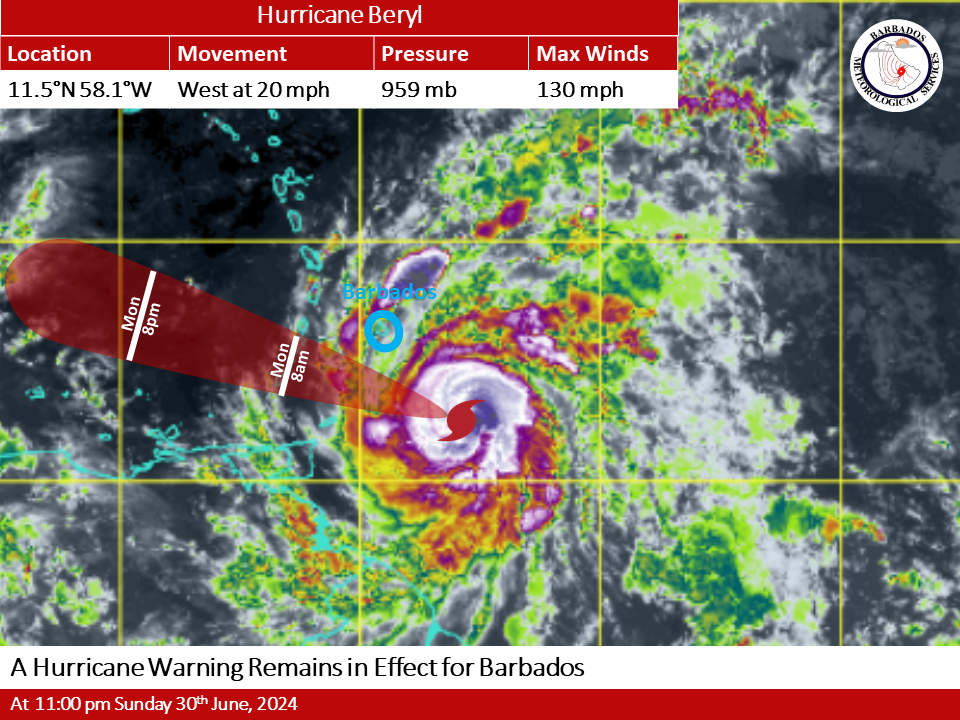
Hurricane Beryl remains a strong Category 4 hurricane with maximum sustained winds of 130 MPH (215 Km/h) and therefore, a hurricane warning remains in effect for Barbados.
An outer band of Beryl will bring heavy showers and storm-force winds across the island after midnight. The center of Beryl expected to pass about 80 miles (130 km) south of Barbados early Monday morning.
Hazard Info
After midnight, storm-force winds will be accompanied by hurricane-force wind gusts as the eye of Beryl passes to the south of the island.
Marine conditions continue to deteriorate with increasingly large ocean swells expected closer to mid-morning. T
he public is encouraged to monitor the BMS, DEM and GIS websites, their respective social media pages, and the local media networks for further information on Beryl.
At 11 p.m. Sunday, the eye was located near 11.5N 58.1W or about 240 km (150 miles) southeast of Barbados. The system is moving in a westward direction at 20 MPH (31 km/h). The minimum central pressure is 959mb. Hurricane-force winds extend outward up to 45 km (30 miles) from the center and tropical storm-force winds extend outward up to 185 km (115 miles).
A Hurricane Warning is issued when sustained winds of 64 knots (74 mph/119kmh) or greater associated with a hurricane are forecast to affect Barbados within 36 hours.


