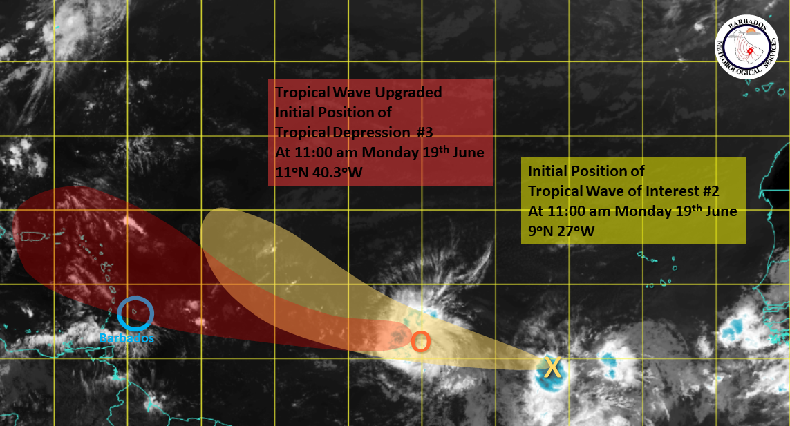
The tropical wave in the Central Atlantic that the Barbados Meteorological Services (BMS) has been monitoring has been upgraded to a depression which could develop into a storm within the coming days.
The BMS said that the centre of Tropical Depression #3 was located near 11N 40W at 11 a.m., with satellite imagery indicating the system has become better organised throughout the morning.
“Conditions will continue to improve for further development into a tropical storm in the coming days. There is still some considerable uncertainty in model guidance on the forecast track with some of the guidance projecting the system can impact the Northern Windwards/Southern Leewards as early as Thursday,” it said in the latest update.
The system has been tracking slightly north of west at 20 miles per hour over the past 24 hours and this general motion is expected to continue over the next few days.
As for the other area of disturbed weather in the far eastern Atlantic, centred near 9N 27W, the BMS said it is closely monitoring disorganized showers associated with this area of interest.
“Environmental conditions are expected to be marginally conducive for the slow development of this system later this week as the system tracks westward at 10 to 15mph,” it added.
While there are no watches or warnings in effect for Barbados, the BMS said that due to the location within the Central Atlantic, the public should continue monitoring its updates as well as postings by the Government Information Service and the Department of Emergency Management.
The next update will be provided at 5 p.m. (PR/BT)


