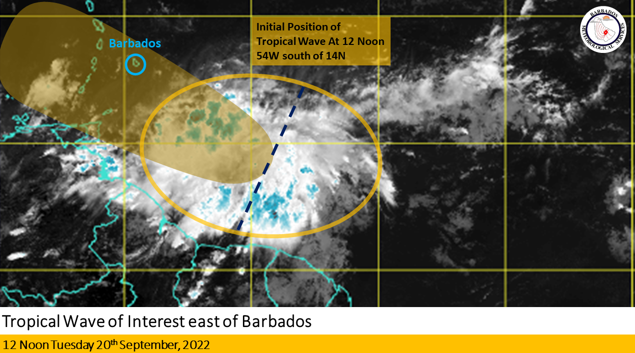
The Barbados Meteorological Services (BMS) on Tuesday continued to closely monitor the progress of a tropical wave located near 54W south of 14N.
It said over the past 12 hours, satellite imagery continued to show a large area of disorganised convection associated with the system tracking westward at around 10 to 15 knots (20 to 30 km/h).
According to the BMS “current model guidance is in agreement with a track south of Barbados during the day on Wednesday.”
“Rapid intensification of the system is unlikely as it approaches Barbados and the southern Windward islands. However, further analysis suggests some slow development as the system moves into the Caribbean Sea by the end of the week.
“With Barbados on the northern fringe of the activity, there is the possibility of 1 to 3 inches of rainfall as the wave affects the island from Wednesday. Winds are likely to be between 20 to 25 knots (35 to 45 km/h) with higher gusts possible during heavy shower activity. An additional 1 to 2 inches of rainfall are possible as activity trailing the wave persists across the island into Thursday,” the BMS stated.
It added that a small-craft advisory is in effect for above-normal sea swells and flash flood watches or warnings may be issued from Wednesday.
“Some beach erosion is inevitable with most or all beaches submerged particularly below the cliffs and specifically at times of high tide. Large open water swells can be hazardous to some vessels.”
The BMS has urged the public to stay alert for updates issued on this system over the next few hours.
Its next update on the system will be at 6 p.m.


