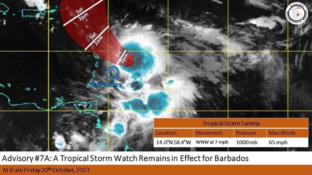
At 8:00 AM the center of Tropical Storm Tammy was located near 14.0N 58.4W, or approximately 90 miles (150KM) east northeast of Barbados. Maximum sustained winds have increased to near 65 MPH ( 100KM/H). Tammy continues to move slowly west-northwestward at 7MPH (11KMH) with a minimum central pressure of 1000 MB.
Some occasional light to moderate showers occurred overnight as feeder bands moved across the island and this is expected to persist during the day with shower activity likely to increase this afternoon and into tonight. Occasional winds gusting to storm force in moderate to heavy showers associated with feeder bands are possible.
The BMS is forecasting rainfall accumulations of around 1 to 3 inches with isolated higher amounts during the passage of Tammy. Any intensification of feed bands to the southeast of the system can result in the watch being upgraded to a warning at short notice.
The public is urged to continue to monitor the progress of this system through updates issued by the Barbados Meteorological Services and follow the guidance and recommendations provided by the Department of Emergency Management. The next advisory will be issued at 11:00 AM Friday 20th October, 2023.
For more information, visit www.barbadosweather.org


